
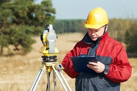
Every successful construction project begins with a clear understanding of the land. Before developers build residential communities, commercial facilities, or infrastructure improvements, they need accurate information about the property. Measurements, elevation changes, existing structures, and boundary locations influence nearly every stage of development. Without reliable site information, even carefully prepared construction plans can encounter unexpected obstacles.
Hiring a qualified surveyor in Salt Lake City, UT helps property owners and development teams understand existing site conditions before making important decisions. Professional surveying provides measurable information that architects, engineers, contractors, and planners use to prepare designs and coordinate construction activities. This early investment supports better project planning and reduces the likelihood of costly measurement errors.
Why Surveying Is Important for Property Development
Land development involves several technical and regulatory considerations. A property might contain uneven terrain, existing utility infrastructure, drainage concerns, access limitations, or recorded easements. Each factor affects how the land can be used.
Surveying helps identify these conditions before construction begins. Accurate measurements allow project teams to evaluate whether proposed improvements fit the available space and align with applicable property requirements.
Professional surveying is particularly valuable when:
Purchasing undeveloped land for construction.
Planning residential subdivisions.
Developing commercial properties.
Expanding existing buildings.
Designing parking areas and access roads.
Preparing sites for grading and drainage improvements.
Having dependable measurements early in the process helps prevent design revisions after construction activities have started.
How Surveying Supports Different Development Stages
1. Initial Property Evaluation
The first stage involves understanding the property’s existing characteristics. Surveyors review available property records, legal descriptions, and previous survey documents before conducting appropriate fieldwork.
This information helps identify boundaries, existing improvements, and physical features that influence development possibilities.
2. Site Planning and Design
Architects and engineers need accurate information to prepare practical development plans. Topographic surveys provide elevation data, contours, and relevant site features that help design teams evaluate building locations and grading requirements.
These measurements are particularly important when a property has slopes, elevation changes, or drainage challenges.
3. Construction Preparation
Once project designs are finalized, construction staking helps transfer planned improvements onto the actual site.
Surveyors establish reference points for building corners, foundations, road alignments, and other construction elements. Contractors use these markers to position improvements according to approved plans. Construction staking leaves physical markers on the site that contractors should protect throughout the work.
4. Project Verification
Surveying can also support construction verification. Depending on project requirements, as-built surveys document the locations and dimensions of completed improvements.
These records help project teams compare actual construction with the intended design.
Understanding Different Surveying Services
Selecting the appropriate surveying service depends on the property’s intended use.
Boundary surveying: Establishes property boundary information using legal records, existing evidence, and field measurements. It supports property transactions, fencing projects, and development planning. Depending on the survey and property requirements, boundary survey work may also result in physical monuments or pins being set to identify property corners.
Topographic surveying: Records elevations and physical features. Engineers use this information when designing grading, drainage, roads, and building layouts.
ALTA/NSPS land title surveying: Provides detailed property information for commercial real estate transactions. Its scope follows applicable standards and the requirements agreed upon by the parties.
Construction surveying: Establishes reference points and measurements needed to position proposed improvements accurately.
As-built surveying: Documents completed construction features to support project verification and recordkeeping.
Understanding these services helps developers communicate their objectives and select an appropriate project scope.
The Role of Modern Surveying Technology
Modern surveying combines established field techniques with advanced measurement and mapping equipment. GPS technology supports positioning, while total stations measure angles and distances with precision.
Depending on the project, laser scanning and three-dimensional mapping also provide detailed representations of existing conditions.
These tools help development teams examine site information, coordinate design decisions, and communicate project requirements more effectively. However, reliable results still depend on appropriate equipment selection, accurate field procedures, and professional interpretation.
Common Development Challenges That Surveying Helps Address
Construction projects frequently encounter problems when teams rely on incomplete property information.
Incorrect boundary assumptions can create encroachment concerns. Inaccurate elevation data can complicate grading and drainage design. Poorly established construction reference points can result in misplaced foundations or other improvements.
A professional surveyor in Salt Lake City, UT helps reduce these risks by collecting and documenting relevant site information before critical decisions are made.
Property owners should also provide existing deeds, parcel information, previous surveys, and preliminary construction plans when requesting services. Clear project details help establish the appropriate surveying scope.
Licensing and Verification
Utah licenses professionals under the title Professional Land Surveyor. Property owners can verify a surveyor’s license through the Utah Division of Professional Licensing before hiring a surveying professional.
Surveying Costs and Turnaround
Surveying costs and turnaround times vary depending on the project’s requirements. Factors such as parcel size, terrain, accessibility, the amount of records research required, existing property conditions, and the type of survey requested can affect both price and scheduling.
Discussing the project scope, required deliverables, and expected timeline with the surveyor in advance helps property owners plan development activities around the completed survey.
Prepare Your Property for Successful Development
Accurate surveying provides the foundation for informed property decisions, organized construction, and effective communication between development professionals. Whether you are planning a residential project, purchasing commercial land, or preparing a site for expansion, reliable measurements help your team move forward with greater confidence.
Before beginning your next development project, consult a surveyor in Salt Lake City, UT to discuss your property requirements. Request a professional assessment, identify the necessary survey deliverables, and obtain accurate site information before construction begins.